Understanding aquatic environments requires accurate data on both their physical structure and chemical conditions. High-resolution surveying and monitoring provide essential insights for biodiversity studies, conservation planning, and ecosystem health assessments, as well as for managing built assets such as ports, harbours, water networks, and wastewater systems. These measurements also generate critical metadata and contextual information that enhance the interpretation of molecular and chemical analyses, deepening insights. Surveying is often carried out using our Unmanned Surface Vessels, which can be deployed as stand-alone platforms or combined with spatial water sampling. Our geophysical and physiochemical services integrate within our Environmental Analysis & Surveillance Insight (EASI) ecosystem, connecting seamlessly with biological and chemical monitoring to deliver a powerful insights and actions for a range of environments.
Geophysical & Physiochemical
Our Geophysical & Physiochemical Technologies
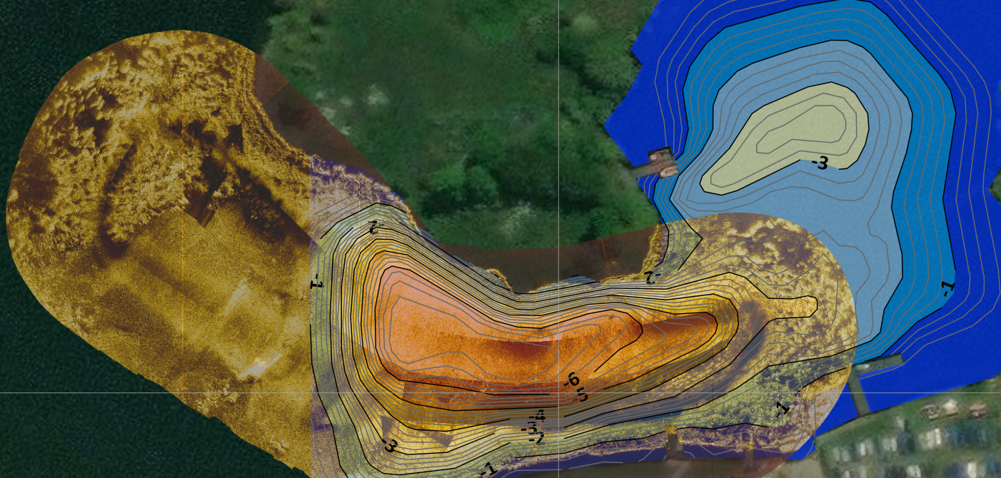
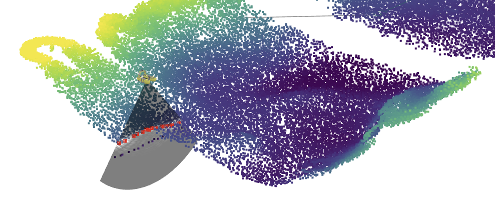
Multi-beam Echosounder
Our multi-beam echosounder delivers high-resolution bathymetric mapping with up to 240 beams per ping and a depth range of around 200 m. This technology produces detailed 3D models of the bed, structures, and submerged assets, supporting precise depth profiling and habitat characterisation. Compact and versatile, the system is ideal for surveys in rivers, reservoirs, ports, harbours, and near-shore environments, providing reliable data to inform environmental assessments, conservation efforts, and asset management.
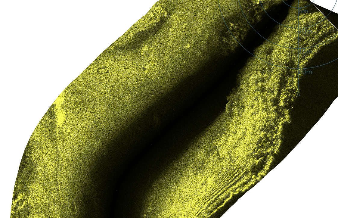
Side-scanning Sonar
Our side scan sonar provides high-frequency acoustic imaging up to 450 kHz, producing crisp, detailed views of the bed surface and submerged features. Unlike multi-beam systems that generate a point cloud for 3D bathymetry, side scan sonar creates a mosaic-style image of the riverbed or seabed, revealing textures, structures, debris, and vegetation. With a range of up to 100 m per channel, it is ideal for habitat surveys, biodiversity monitoring, and the inspection of assets in ports, harbours, reservoirs, and rivers.
Parameters
- pH
- Salinity
- Dissolved Oxygen
- Temperature
- Turbidity
- Ammonia-Nitrogen NH4+
- Nitrogen Nitrate Nitrate (NO3)-
- Blue-green Algae
Physiochemical Sensing
Physiochemical sondes provide real-time monitoring of key water quality parameters, offering essential context for both ecological and asset assessments. Parameters such as pH, salinity, dissolved oxygen, temperature, turbidity, ammonia, nitrate, and blue-green algae deliver insights into the health and stability of aquatic systems. For example, dissolved oxygen is critical for aquatic species, nutrients drive algal growth and ecosystem balance, while turbidity and salinity affect both biodiversity and infrastructure performance. Using our Unmanned Surface Vessels (USVs), these measurements can be collected across transects to generate geospatial maps of water quality, providing a powerful tool for identifying trends, hotspots, and risks. When combined with biological and geophysical data, they contribute to a comprehensive understanding of aquatic environments.